


A new satellite constellation design method achieves global Earth observation within 35 minutes using optimized configurations of basic and accompanying satellites in LEO mega constellations.
A Leap Forward in Earth Observation
Imagine looking at the entire Earth every 35 minutes — not through magic, but through cutting-edge satellite design. This is no longer just a sci-fi dream. A team of scientists has unveiled a powerful concept: a satellite mega-constellation that can image nearly the entire planet with astonishing speed.
A Highly Coordinated Cosmic Network
To achieve this remarkable feat, researchers designed a constellation of 891 low Earth orbit (LEO) satellites. These satellites form 81 primary groups, each accompanied by 10 secondary satellites. Working together, they create a synchronized dance around the Earth, ensuring no spot (outside the polar regions) goes unseen for more than 35 minutes.
Moreover, this formation reduces overlap and maximizes efficiency — a crucial consideration when dealing with hundreds of moving parts in orbit.
The Science Behind the System
This constellation is no arbitrary layout. Scientists optimized it using extensive simulations. They aimed to balance speed, coverage, and feasibility. As a result, they settled on the following key specifications:
- Orbital Inclination: 66°, ideal for mid-latitude coverage
- Orbit Shape: Circular (eccentricity = 0)
- Group Imaging Width: 1500 km
- Individual Satellite Imaging Width: 140 km
- Coverage Time: Full global imaging in just 35 minutes
By running iterative tests, the team fine-tuned the placement and movement of each satellite. Ultimately, they found a design that allows for rapid, recurring observation with minimal gaps. Dailyscitech
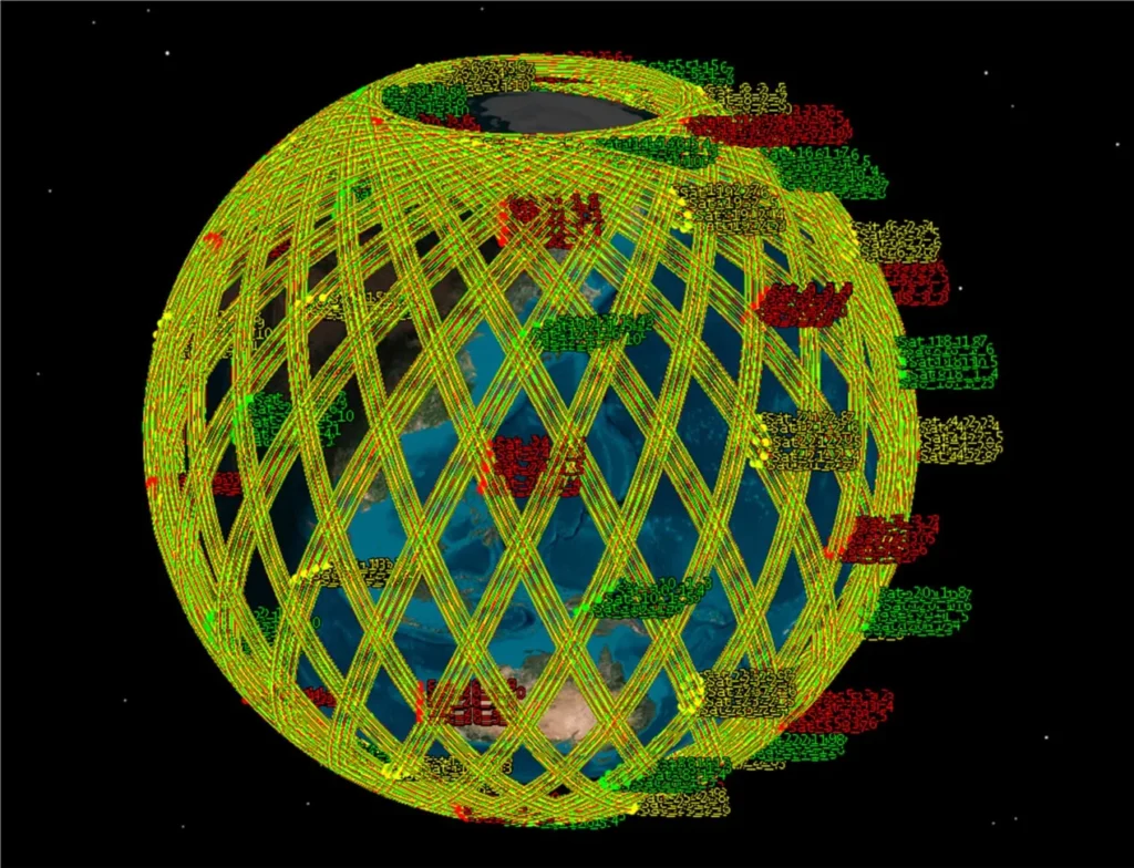
Final LEO mega constellation configuration. Credit: Space: Science & Technology
Why This Matters: Real-World Impacts
Such rapid imaging can transform how we respond to global challenges. For example:
- Disaster Response: Governments can assess flood, wildfire, or earthquake damage almost in real time.
- Climate and Environmental Monitoring: Scientists can track deforestation, ice melt, or ocean pollution with unprecedented frequency.
- Agriculture: Farmers and researchers can monitor crop health, predict yields, and detect changes in land use.
- Urban Planning: Cities can analyze traffic, infrastructure development, and population growth from space.
Clearly, this technology isn’t just about looking at Earth — it’s about helping us protect it. Dailyscitech
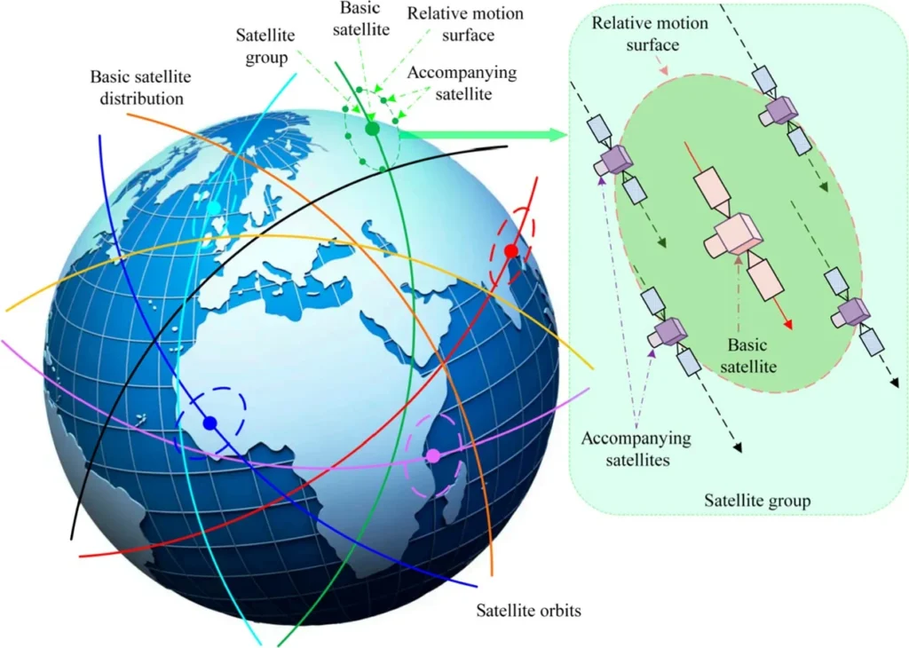
Orbital distribution of LEO mega constellation. Credit: Space: Science & Technology
Challenges and the Road Ahead
Despite its promise, deploying such a vast network of satellites presents real challenges. Launching hundreds of satellites requires significant funding, collaboration, and careful planning. Additionally, increased orbital traffic raises concerns about space debris and satellite collisions. Dailyscitech
Therefore, the success of this project will depend on cooperation between international space agencies, private aerospace companies, and regulatory bodies. If done right, it could mark the dawn of a new era in Earth monitoring. Dailyscitech
Reference: “Configuration Design Method of Mega Constellation for Low Earth Orbit Observation” by Yuheng Yang, Xiande Wu, Jiamin Li, Jie Zang, Jianchun Lu and Ralf Zgeib, 18 June 2024, Space: Science & Technology.
DOI: 10.34133/space.0175