


South Africa is slowly rising, and for years, scientists assumed this uplift was caused by movements deep within the Earth. But new research offers a surprising explanation: drought-driven water loss.
A Surprising Elevation
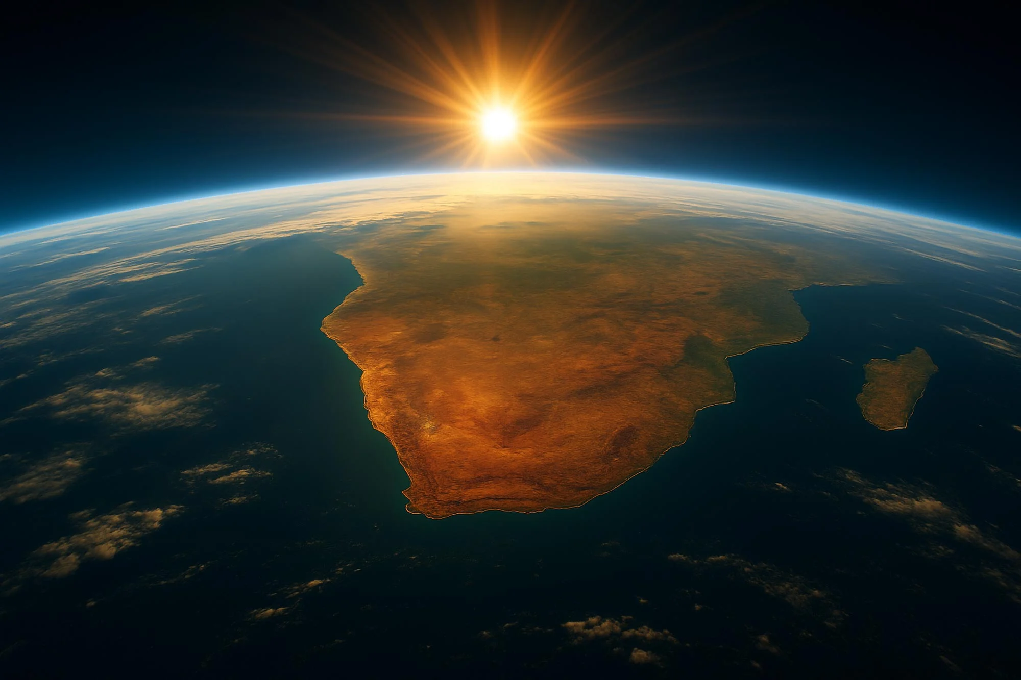
In a fascinating twist of nature, South Africa is gradually ascending—emerging from the ocean at a rate of up to 2 millimeters per year, depending on the region. This phenomenon, observed over the past decade, has intrigued scientists who initially attributed it to deep Earth processes. However, recent research suggests a different culprit: climate-induced droughts leading to significant water loss. Dailyscitech
The Role of Water Loss
Traditionally, such uplift was thought to result from mantle plumes—columns of hot, buoyant rock rising from deep within the Earth’s mantle. Yet, a study conducted by the University of Bonn has shed new light on the situation. By analyzing data from Global Navigation Satellite Systems (GNSS) stations across South Africa, researchers discovered a strong correlation between land uplift and periods of drought. Specifically, regions like Limpopo and Mpumalanga showed uplift patterns closely aligned with hydrological models, indicating that the loss of groundwater and surface water due to prolonged droughts is causing the land to rise. Dailyscitech
Implications for the Future
This revelation has significant implications. It highlights how climate change and associated droughts can directly impact the Earth’s crust, leading to measurable geological changes. Understanding this relationship is crucial for future urban planning, agriculture, and water resource management in the region. Dailyscitech
(red = rising; blue = sinking). The rise was particularly pronounced in the drought between 2015 and 2019. Credit: AG Kusche/University of Bonn
A New Perspective on Earth’s Dynamics
The discovery underscores the interconnectedness of Earth’s systems. It illustrates how atmospheric conditions, like prolonged droughts, can influence geological processes, challenging previous assumptions about the causes of land uplift. Dailyscitech
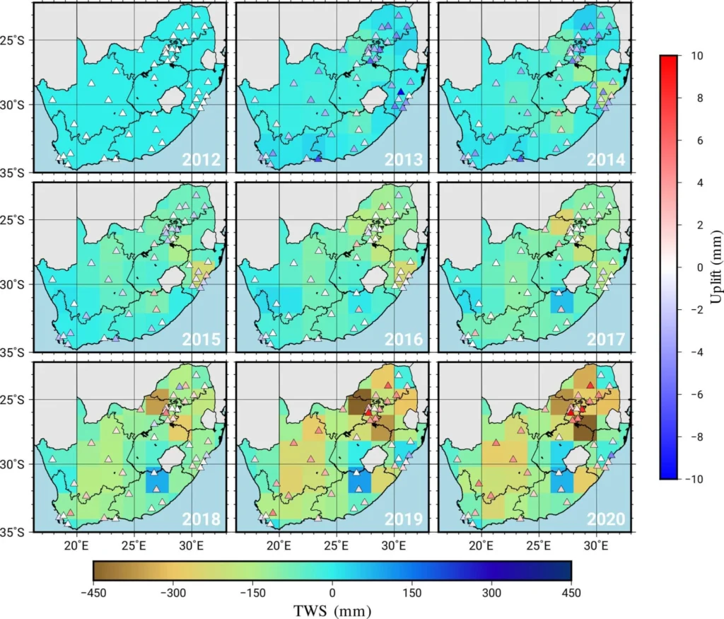
In South Africa, between 2012 and 2020. The browner the region, the higher the water loss. The triangles represent GPS stations. A red triangle means that this station has risen in height since 2012. Credit: AG Kusche/University of Bonn
Curious About Earth’s Hidden Movements?
What other subtle shifts might be occurring beneath our feet, unnoticed? As we continue to study our planet, we may uncover more surprising interactions between climate and geology. Dailyscitech
Reference: “GNSS Observations of the Land Uplift in South Africa: Implications for Water Mass Loss” by Christian A. Mielke, Makan A. Karegar, Helena Gerdener and Jürgen Kusche, 9 April 2025, Journal of Geophysical Research: Solid Earth.
DOI: 10.1029/2024JB030350